Maritime Planning Associates
Projects Portfolio

SHARC: System for Hazard Assessment of Released Chemicals
US Government | Industry
Developed for both government and private sector clients, SHARC is a particle-based modeling system that simulates the transport and fate of hazardous materials in aquatic environments. It accounts for key processes such as dissolution, volatilization, settling, and decay, supporting a wide range of substances including oil, industrial chemicals, and pathogens. SHARC has been applied in ports, rivers, coastal zones, and inland waterways for both emergency response and long-term planning. Its modular architecture and rapid scenario adaptability make it a powerful tool for real-time operations, regulatory planning, and national security applications.

Nationwide Water Quality Database for Hazard Modeling
US Government | SHARC
MPA developed a comprehensive daily climatological database of water quality parameters for over 2,500 watersheds across the continental U.S. Using a combination of Self-Organizing Maps and K-means clustering, the system produces statistically representative water quality estimates for key parameters such as temperature, pH, salinity, and suspended matter. This database was fully integrated into the SHARC hazard modeling system and is now used to improve the fidelity of waterborne hazard assessments across the United States.

Automated Limnological Parameter Estimation Using Machine Learning
US Government | SHARC
MPA automated the extraction and estimation of critical limnological parameters — including lake depth and volume — by combining remote sensing data, digital elevation models, and national hydrography datasets. These morphological inputs, vital to understanding the fate and transport of hazardous releases, are now dynamically derived for thousands of lakes and reservoirs, including those lacking prior measurements, enhancing SHARC’s capacity for modeling in both data-rich and data-sparse environments.

Predictive Modeling of OCONUS Water Quality Using Remote Sensing
US Government | SHARC
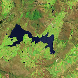
To address data scarcity outside the U.S., MPA developed a machine learning framework that predicts water quality parameters — specifically pH — using overhead hyperspectral imagery. Trained solely on U.S. data, the model was successfully tested on lakes in Europe and Africa. This capability enables waterborne hazard modeling in remote or denied areas, providing a foundation for global operational applications.

Machine Learning Prediction of Vertical Lake Temperature Profiles
US Government | SHARC
MPA created a decision-tree-based machine learning framework to predict vertical temperature profiles in lakes and reservoirs. Using publicly available lake morphology and atmospheric data, the model achieves 81% accuracy and is optimized for rapid deployment in operational scenarios. This approach enables fast, resource-light modeling for high-consequence events like hazardous material spills without needing dense in-situ measurements.

Joint Effects Model
JPEO-CBD | General Dynamics Information Technology
MPA played a central role in the development of Joint Effects Model Increment 2 (JEM2), contributing across the full software development lifecycle - from requirements and architecture to integration, testing and sustainment. Our team led development of key subsystems for meteorological processing, radiological transport, incident source modeling, and ocean-based hazard dispersion. Our work enabled JEM2 to ingest hi-fidelity environmental data, interoperate with multiple DoD systems, and support multi-domain CBRN hazard forecasting.

Advanced Mission Planning System
US Navy | General Dynamics Mission Systems
MPA supported the U.S. Navy’s Advanced Mission Planning System (AMPS) initiative by integrating real-time environmental data into a digital mission planning system for autonomous and distributed operations. We developed a modular weather ingest capability that enabled AMPS to operate in disconnected environments — supporting route planning, execution monitoring, and simulation-based training. Our contributions helped advance how mission planning is conducted and positioned AMPS for integration into future operational planning systems across the Navy and joint force.

METOC Model Viewer: Tactical Environmental Decision Aid
NAVOCEANO | NSWDG
Developed for the Naval Oceanographic Office and Naval Special Warfare Development Group, the METOC Model Viewer (MMV) is a cross-platform, geospatially enabled decision support tool for maritime operations. MMV integrates real-time and forecasted environmental data with custom analysis tools to support tactical planning — enabling route and platform selection, gear configuration, sensor placement, and timeline optimization. The system includes specialized modules for surf prediction, spectral wave analysis, tidal harmonics, solar/lunar planning, and drifter uncertainty assessment. Built for extensibility and operational speed, MMV enhances situational awareness and mission readiness in complex littoral environments.

Environmental Data Enterprise
US Government
As part of the Environmental Data Enterprise, MPA developed key system components that automate the collection, normalization, and dissemination of environmental data critical to defense and hazard modeling applications. Our contributions include the Environmental Data Retrieval webservice, which enables users to extract tailored NetCDF files via standardized OGC requests; an automated ingest pipeline for the ocean forecast models; and an interactive visualization interface for assessing atmospheric and ocean conditions. We also reimagined system status boards to provide real-time insight into data availability and model coverage. These tools simplify and stabilize data access for analysts and modeling platforms, improving resilience to upstream data disruptions and enhancing operational readiness.

FSO Safer Spill Contingency Modeling
US Government
In support of U.S. government contingency planning, MPA used SHARC to simulate high-resolution potential oil spill scenarios stemming from the FSO Safer — a deteriorating tanker off the coast of Yemen carrying over 1 million barrels of crude oil. Incorporating seasonal wind, current, temperature, and salinity data, the model forecasted oil transport and fate across the southern Red Sea under both summer and winter conditions. Results identified high-risk zones spanning over 250 miles of coastline, with key vulnerabilities including desalination facilities, coral reefs, fisheries, and ports. MPA’s modeling enabled US and international partners to develop data-driven response plans, shaping humanitarian coordination, ecological protection strategies, and diplomatic preparedness.

Haiti Cholera Risk Forecasting
US Government
Following the 2021 earthquake and Tropical Storm Grace, MPA supported U.S. government efforts to forecast cholera risk in southern Haiti. Using a spatial SIWR (Susceptible-Infected-Waterborne-Recovered) model adapted from SHARC, MPA integrated rainfall, terrain, hydrology, and population data to simulate transmission dynamics across Nippes, Sud, and Grand’Anse. The model identified high-risk areas, including Les Cayes and Jérémie, with 10–14 day lead times — enabling targeted deployment of sanitation and public health resources. This work demonstrated SHARC’s adaptability for biological hazard forecasting in post-disaster settings.